You are here
Rare! Wwii 1944 Operation Queen German Defenses Army Assault Map Siegfried Line
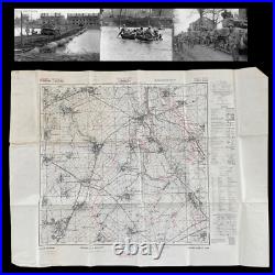
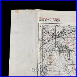
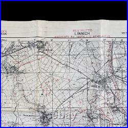
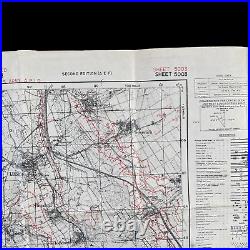
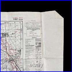
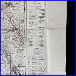
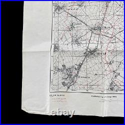
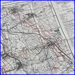
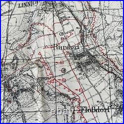
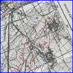
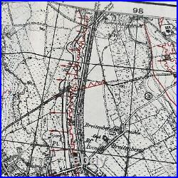
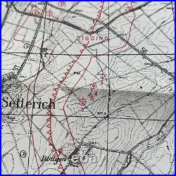


This incredibly rare and museum-grade WWII Ninth U. Army "RESTRICTED - GERMAN DEFENSES" map was used during the infamous Operation Queen with the objective. Queen' was a US offensive by Lieutenant General Omar N. Army Group on the Rur (Roer in French and Dutch) River and Siegfried Line in western Germany as a staging point for a subsequent thrust over the river to the Rhine river and thus deeper into Germany (16 November/15 December 1944). The offensive commenced on 16 November 1944 with one of the heaviest Allied tactical bombings of the war. However, the Allied advance was unexpectedly slow, against heavy German resistance, especially in the Hürtgen Forest through which the main thrust of the offensive was carried out. By mid-December, the Allies finally reached the Rur and tried to capture its important dams, when the Germans launched their own offensive, dubbed.
The ensuing Battle of the Bulge led to the immediate cessation of Allied offensive efforts into Germany until February 1945. Maps marked RESTRICTED were done so when they were being actively used in that specific theater of operation, meaning that this map was not an operational planning map and was however a strategic and objective map used on the battlefield. What makes this WWII map so incredibly sought after is the incredibly rare'NOVEMBER 15th, 1944' overprint done of the German defenses in the area. These overprint assault maps were vital to U. Infantry divisions as well as Armored Divisions in the area to plan attacks against the German and Panzer troops in the area. These symbols denoted German artillery emplacements, machine gun bunkers, anti-tank ditches, pillboxes, etc. These RESTRICTED overprint defenses maps are extremely rare as not many were printed or survived. These maps were overprinted "IN THEATER" based on the most updated Allied aerial intelligence photo over that specific region. A great deal of secrecy and intelligence went into the planning, preparation, and distribution of this map.
This map was distributed to higher ranking soldiers and was imperative to not have captured or fall into enemy hands. It is believed that less than ten Operation Queen German defense overprints still exist. Linnich and Operation Queen Background.
In June 1944, the Allies conducted the invasion in Northern France and opened a new front. After the Allied breakout from Normandy, the German. Was involved in a string of disastrous battles in July and August, most notably the Falaise pocket.
Following those events, the German defense in northern and western France disintegrated, leading to a hasty retreat of the German forces. The rapid Allied advance together with the ongoing march of the Red Army in the east let the Allied High command believe that the Wehrmacht was about to collapse and total victory could be achieved by Christmas 1944. The Allies, therefore, launched a high-risk plan for a direct thrust through the Netherlands into Germany, called Operation Market Garden. This overly ambitious plan failed, as the Wehrmacht was able to reorganize itself and consolidate its strength. By mid-September, the Allied advance abruptly ended, as the Allies suffered from a logistics crisis, outrunning their supply lines. This gave the Germans further time to prepare for the upcoming Allied offensives. The Germans now could man the fortifications of the. (Siegfried Line), although its old bunkers were more symbolic than a real obstacle for the Allies.

